Saturday, November 6, 2010

Hackensack River NJ Fairleigh Dickinson University to New Bridge Rd. (From the Archives July 5th )


View Hackensack River in a larger map
 This was my first paddle on the Hackensack River . It was a curious mix of a very urban environment and  considerable river vegetation.
I put in at the Fairleigh Dickinson University, having missed the road into Johnson Park .
The put in 


I went down river a very short distance,  wanting to paddle upriver on the rising tide and turn around at high tide.


I paddled up river, passing under the Route Four bridge. I didn't really realize that I knew where I was until I spotted the Saks sign plastered on a wall rising up behind the reeds. 


Past the Mall, there was a creek  on the western side. I went up here for a surprising distance. Lots of commercial activity on the banks, but again, a great deal of vegetation for such an urban area. 


Some type of Solanum I guess.


Back on the river  I continued upriver , at some point( I seem to have forgotten exactly where) I passed under this bridge with a turning mechanism.


I noted something in the reeds, and paddled over, thinking there was a dead bird of some sort. It was a bird, but it was of the plastic flamingo variety. 

It seemed way too good to pass up. I saved it from its ignominious state, and it now resides in  our apartment , gracing our 'garden '. 


Great to see some riverside sculpture, especially  the back view with the homeland displayed so well. Sadly Tasmania is missing, but its still a good rendering.


After about 4 hours on the river, I reached the put in and  I loaded up the kayak with my trophy firmly in hand. 


Having noted that I was so close to the Riverside Mall, there was an added bonus , as I stopped to pick up food for our dinner. A fitting end to a great day's paddling 


Wednesday, November 3, 2010

Bear Mountain NY (from the archive June 2010)

Put in at Bear Mountain after driving around trying find the launch by  following  the worst map known to humankind (courtesy of the Bear Mountain Park Visitor's Center) . When I finally did find it, I discovered it was not a boat ramp as I had hoped, but a dock. Access was complicated by the fact that one had to drag the kayak down a fairly steep and winding path and then under a railway line before getting to the pier and dock -  all part of the fun.
The wind was calm, but forecast to rise, so I had planned to paddle around Iona Island, where the bird sanctuary is. Seeing a sign prohibiting entry to this area under the railway bridge  I did my civic duty and refrained from entering. 
I figured I would see plenty of birds by paddling around the river side of the island, which I did.
There was not much distance  to this paddle , so I turned and headed upriver under the Bear Mountain Bridge.                                                                                          Around Iona Island 
By this time the wind had picked up a little and the Hudson was becoming a little choppy.  
The Hudson chop
  I paddled under the bridge and noticed a small creek running into the river. It went under a bridge and the foliage became more dense.  Paddling on I was delighted to find a beautiful creek, enging not far along with a waterfall. The scene was idyllic; no one else around, a hot day and fresh water spilling over a substantial rock wall into a rocky pool. There was nothing for it but to stop and have lunch and a swim. It was one of those surprise finds which  make the life of a kayaker so wonderful.


Checking Googlemaps on my phone, I found  the creek was known as Popolpen Creek. Definitely worth a return trip when the weather warms up again. 


Looking back towards the Hudson from Popoplen Creek 


Heading back to the dock I saw this huge stag head sculpture  neatly camouflaged on the bank. Another little gem!

Saturday, October 30, 2010

Susquehanna River Upstate New York Oct 30th 2010


View Crumhorn Landing to Portlandville NY in a larger map


The boat ramp at Crumhorn Landing, in the Susquehanna State Forest .
A cool cloudy day. I rugged up with many layers, only to find that I was too warm.
Perhaps the thermal, skivvy, t-shirt, wincheater and spray jacket was a little too much. 


Most of the leaves have fallen, but it was still a pretty paddle .


Here are two plastic flamingos who are clearly close kin to the one I found on the Hackensack River.a few months  ago.


 The bridge at Portlandville.


The Susquehanna begins just north of this section,running from Ostego Lake near Cooperstown  into Maryland 440 miles to the south.                                                                                               


                    A new fungus.


Back at Crumhorn


3 hours on the River - very nice .

Sunday, October 24, 2010

Hudson River -Cold Spring

Another beautiful day. I hadn't planned to go out, but I couldn't resist  getting out again. Drove up to Cold Spring and put in by the station at Foundry Dock . 


 The boat ramp at Cold Spring 
(Foundry Dock) 
Had planned to paddle around Constitution Marsh, but but duck season put paid to that. I paddled upriver a little way, then headed back downriver. I paddled around a rocky point, where there were birds galore. 


                       Wild and woolly


My lunch spot 


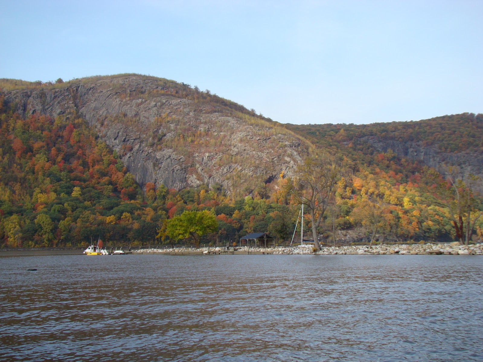
The leaves are  fabulous; it  seems to be peak foliage at this latitude.


Delaware River and Delaware Raritan Canal


As the end of October draws near, the weather is still very mild. The temperature today reached 64 F (18 C degrees), and the wind was calm. I put in  to the Delaware -Raritan Canal at Washington Crossing ( site of George Washington's famous crossing) .

I paddled upstream. There is a towpath along the length of this section and many cyclists and walkers cruised by. 
Ubiquitous Canada Geese 


Fall foliage on the canal. 


                      Old abandoned lock


 Local wildlife The Redbelly Turtle     Pseudemys rubriventris


Canal Scenes 
There were several abandoned bridges crossing the canal 


The towpath is just visible at the top of the river bank. 


About 5 miles up I pulled out of the canal and dragged the kayak across the tow path and down a bank to the Delaware River which was only about 50 meters  from the canal  at this point. 
This made the trip extra easy, as I was able to do a round trip in the kayak. 
The river was moving fairly well. I was surprised how shallow the river was in parts


 The Delaware River- Border of Pennsylvania and New Jersey 
Titusville


Great Blue Heron - Juvenile 
from Wikipedia... 

Washington's crossing of the Delaware River, occurring on December 25, 1776 during the American Revolutionary War, was the first move in a planned surprise attack organized by George Washington against the Hessian forces in Trenton, New Jersey.
Planned in partial secrecy, Washington led a column of Continental Army troops across the icy Delaware River in a logistically challenging and potentially dangerous operation. Other planned crossings in support of the operation were either called off or ineffective, but this did not prevent Washington from successfully surprising and defeating the troops of Johann Rall quartered in Trenton. The army crossed the river back to Pennsylvania, this time burdened by prisoners and military stores taken as a result of the battle
The bridge at Washington Crossing 


There was no one else on the river; it  was a great day on the water.