View Passaic Li Jan 16th 2012 Little Falls to Two Bridges in a larger map
Forecast for 11:00 am
Air Temp 0 C (32 F)
Wind Chill - 3 C (27 F)
Winds SSE 6 kmph (4 mph) Gusts up to 8 kph (5 mph)
| Drainage area: | 100 mi2 |
| Discharge: | 356 cfs |
| Stage: | 4.52 ft |
| Date: | 2012-01-16 05:15:00 |
| Flood stage: | 6 ft |
| Percentile: | 87.63 % |
| Class symbol: | |
| % normal (median): | 257.97 % |
| % normal (mean): | 200.96 % |
I headed for the park on Stanley Rd., but did not put in owing to the river narrowing and freezing upstream. Did get a picture of the water gauge though , before I left to drive up river and put in just above Little Falls ( Beatties Dam)
 |
| Water Gauge near Chatham ( gauge reading above) |
 |
| The weir at Stanley Rd near Chatham |
This was the gauge reading for the river just before the turn around (Picture of this gauging station is below the table.)
I was out for just under three and a half hours. Distance traveled - Approx 7 miles .
| Drainage area: | 734 mi2 |
| Stage: | 5.27 ft |
| Date (stage): | 2012-01-16 15:30:00 |
| Flood stage: | 9 ft |
| Class symbol: | |
| Water temperature: | 1.3 oC 2012-01-16 15:00:00 |
| Specific conductance: | 348 μS/cm 2012-01-16 15:00:00 |
 |
It took a while to find a launching spot, but I found a boat ramp of sorts adjacent to Fern River Park Island.
 |
| Launch - heading out |
 |
| Launch - Returning |
The river was running at reasonable pace; one could not really stop padding for long, before finding oneself floating back downriver.
Only geese and ducks were out today. No other people on the river; probably a tad cold for most people .
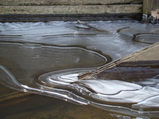
There were some very attractive odd shaped icicles and icing along the river bank. Photos of this and other scenes follow.
Ice Designs
 |
| A small tributary running in alongside of I80 |
 |
| Two Bridges |
 |
| I 80 bridge |


No comments:
Post a Comment