View Passaic River 30th Dec 2011 Rt 510 Launch in a larger map
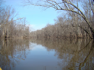
Continuing on my exploration of the Passaic, I put in at Rte 510 and headed south (upstream). There is such a lot of water, complete lakes, which on Google sat pics, show up as grassy areas. So expansive was the water, that I paddled way off of the river channel and ended up at a dead end. I checked on the GPS, and I was way off course. Even after I turned around and headed back to the channel, I could not make out the southward channel. As it was, I was not far from yesterday's paddle so I turned around and headed downriver until I gto the Rte 10 Bridge,which was where I had turned around yesterday. I have now completed that section of the river.
It was much milder today, around 8-9 degrees C. I had one less layer of clothing on top, and manged to complete the paddle without major freezing of extremities.
I was on the water for about 3 hours.
 |
| Launch |
 |
| Rte 510 Bridge |
 |
| Cedar Hill Country Club |
Little wildlife, duck and geese; that's it.


No comments:
Post a Comment